HDRFS team visits project site outside Reno
The field site along Red Rock Road is where many of the basic science projects stemming from the HDRFS program will be run in the coming years.
By Amanda Heidt
May 2025
Nearly every member of the Harnessing the Data Revolution for Fire Science (HDRFS) project has a connection to the program’s field site along Red Rock Road outside Reno, even if they haven’t yet visited in person. It’s here that members of the team develop and refine many of the tools and protocols underlying the program’s scientific goals, and where collaborations between the five components will soon take root. At this year’s annual meeting, attendees were invited to tour the site together, and to hear about the projects planned there for the next few years.
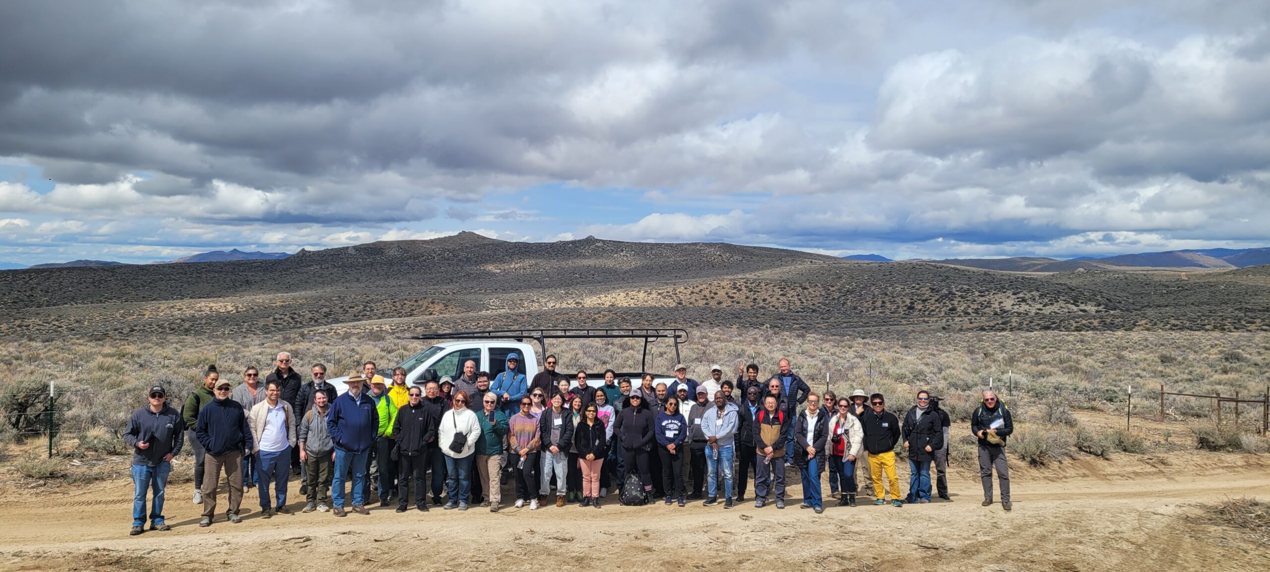
HDRFS team visited the Red Rock field site outside Reno. (Credit: Scotty Strachan)
Prior to visiting the site, attendees first stopped at a warehouse near Reno’s regional airport to view the project’s mobile flux chamber—a 4,000-pound greenhouse painstakingly assembled over the course of 300 hours. The goal, according to Ecology component lead Jay Arnone, is to use the greenhouse to determine how factors such as plant density, species composition, and soil moisture affect how much carbon is released in a wildfire. At the site, some plots have burned more recently than others, or contain more invasive species than others, meaning the team has a swathe of different habitat types to work with.
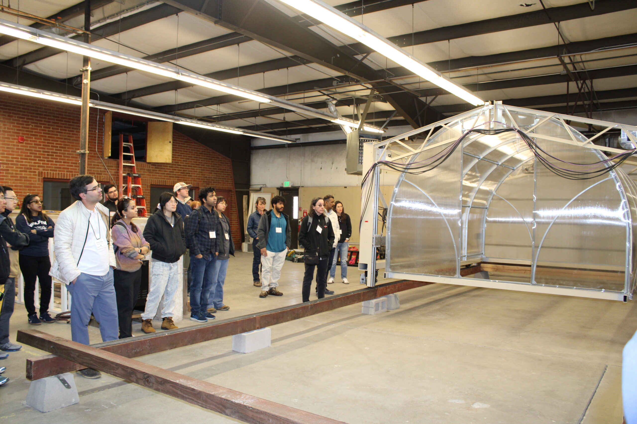
HDRFS annual meeting attendees observed the mobile flux chamber. (Credit: Mayara Cueto-Diaz)
In the last year, Arnone and Nic Beres, an assistant research scientist at the Desert Research Institute (DRI), have updated the chamber’s design, control, and ability to travel autonomously along a 300 meter track currently under construction at Red Rock Road. Soon, the team will disassemble and transport the chamber to the field site to begin collecting data. “We’ve been working towards this moment for years, and we’re excited now that it’s so near,” says Beres. “Once we’ve gotten everything set up, we should be able to monitor our experimental plots on a near-continuous basis, taking data 24/7 that we can access from back on campus.”
At Red Rock Road, visitors then braved a blustery afternoon to learn about the work being planned for the site as well as projects currently underway.
Members of the Ecology and Cyberinfrastructure Innovations (CII) components have already partnered on a project to use drones to study the “digital ecology” of sagebrush ecosystems, for example, comparing measurements taken by drones to those taken by hand by researchers. Later in 2025, the entire HDRFS team will hold a series of controlled burns there, allowing the drone team to collect data on temperature, pressure, humidity, carbon dioxide, and particulate matter from the smoke plumes during and after the fires. “Because of preliminary work we’ve done here at the site, we’ve been able to rethink and really understand the types of sensors we need to study these burns with the detail we want,” says Christos Papachristos, the director of the Robotic Workers Lab at the University of Nevada, Reno (UNR).
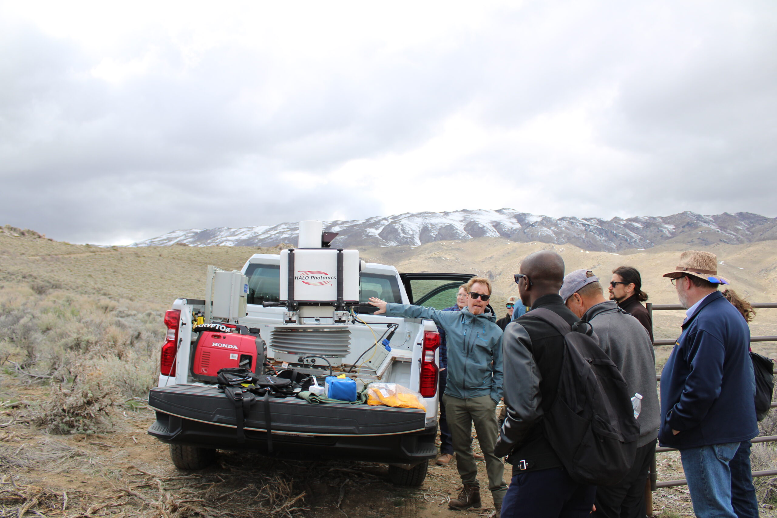
Neil Lareau demoed his mobile LiDAR machine. (Credit: Mayara Cueto-Diaz)
Neil Lareau, an atmospheric physicist at UNR and member of the fire emissions and their atmospheric aging (FEAA) component of HDRFS, also demoed his research group’s new mobile LiDAR machine. The system, which rests atop a spring-like stabilizer in the bed of a white pickup truck, means that the group can now deploy and respond to fires far more quickly than they could before, and also access more remote locations to capture real time data on wildfire smoke plumes. Lareau says that the group is currently working on setting things up such that the LiDAR can function while the truck is driving, and he hopes to demo the system on an upcoming controlled burn before turning to actual wildfires later this year.
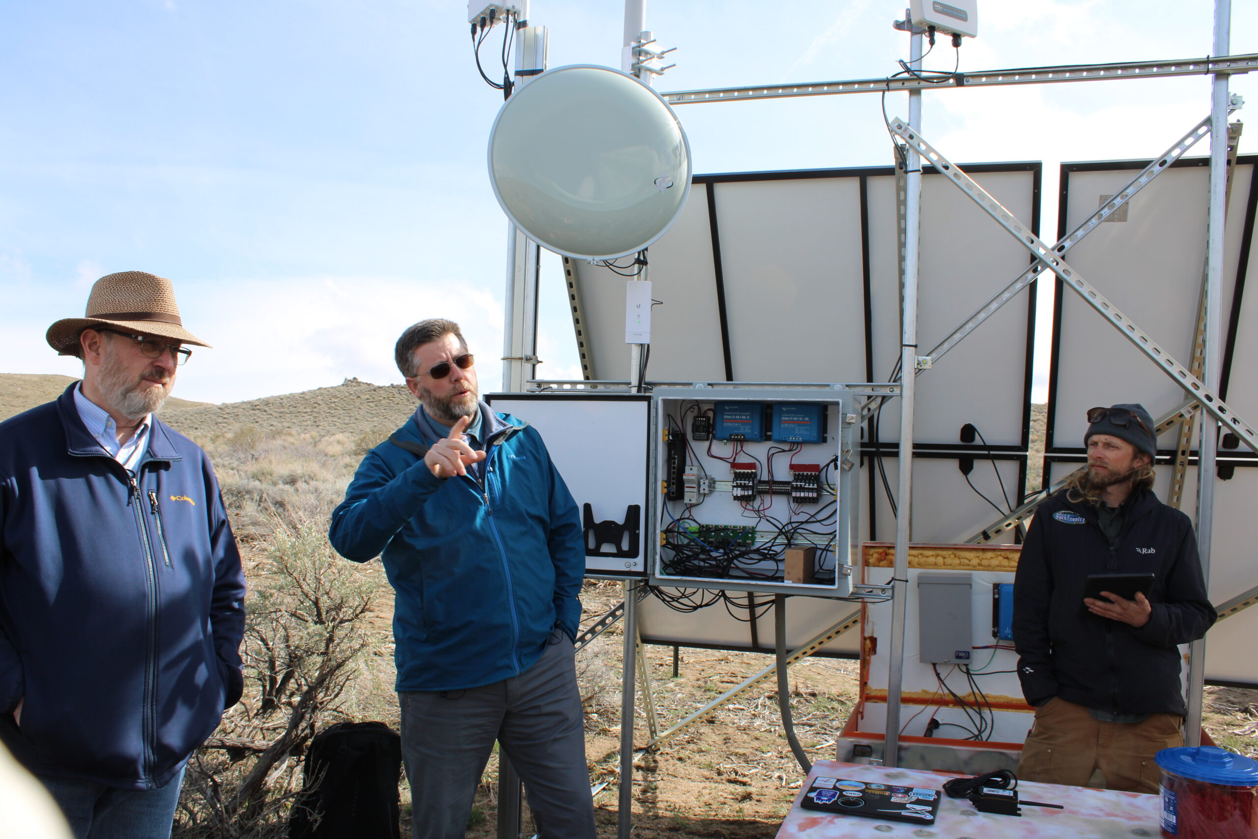
Scotty Strachan and Jehren Boehm showcased the technological infrastructure created at the field site. (Credit: Mayara Cueto-Diaz)
Equipping the Red Rock Road site to support the science happening there has been an immense yet satisfying challenge, according to Jehren Boehm, a PhD student in the lab of CII lead Scotty Strachan.
The area’s isolation, coupled with the different needs of each research group, means that CII has needed to tap into existing technological infrastructure while also creating new systems specifically for HDRFS researchers. Boehm helped integrate the field site into a network run by the seismology group at UNR, for example, which he says is slowly growing into a wider, shared cluster of seismic sensors, fire cameras, and other infrastructure related to environmental monitoring. The network, called Nevada SciNet, began as a shoestring operation overseen by volunteers, but has now drawn interest from funders interested in supporting long term monitoring projects.
“This realization that we can leverage technology to continuously and autonomously monitor for these types of threats has brought in a lot of funding, which has allowed the network to grow,” Strachan says. “There was a time when doing this type of long term ecological monitoring meant dipping into our own pockets, but we’ve finally gotten to a place where funders see the importance of these projects.”
The result is that scientists can power their devices and process data on-site, while also monitoring experiments remotely. Boehm and the rest of the CII team have also built layers of access into the system, such that people without a lot of technological knowhow can still connect to and use the infrastructure. During a demonstration, Boehm shared a new class of inexpensive sensors that can be easily set up within the broader Red Rock Road technological ecosystem.
“Using a single page of instructions, any student can provision a sensor onto the network and deploy it to measure whatever they want to out in the field,” he says. “And by connecting the sensor to our local network, we can transmit all the data back to our larger data center. There’s a lot of work that goes on behind the scenes to make that happen, but we’ve set it up such that the user doesn’t have to worry about any of that background tech.”
 Acknowledgement: This material is based upon work supported by the National Science Foundation under Grant No. OIA- 2148788.