Testing the waters: HDRFS links wildfires with hydrology
After a series of controlled burns at the project field site, the hydrology team is monitoring the moisture content and soil properties of a torched landscape.
By Amanda Heidt
March 2026
In November of last year, the Harnessing the Data Revolution for Fire Science (HDRFS) team gathered at the project’s field site off of Red Rock Road to witness a major milestone. As fire officials stood by, sections of the land the researchers had spent years studying were set blaze, amounting to half of the site’s 20 experimental plots.
Far from a catastrophe, getting to this point was marked a major victory — the culmination of a vision that has been around since the first days of the project, back in 2022. For years, HDRFS scientists have been collecting valuable data about what a sagebrush ecosystem looks like before it burns, including its plant communities, soil properties, and nutrient levels. Soon, they’ll know what it looks like after, and how different factors affect post-fire recovery across the landscape.
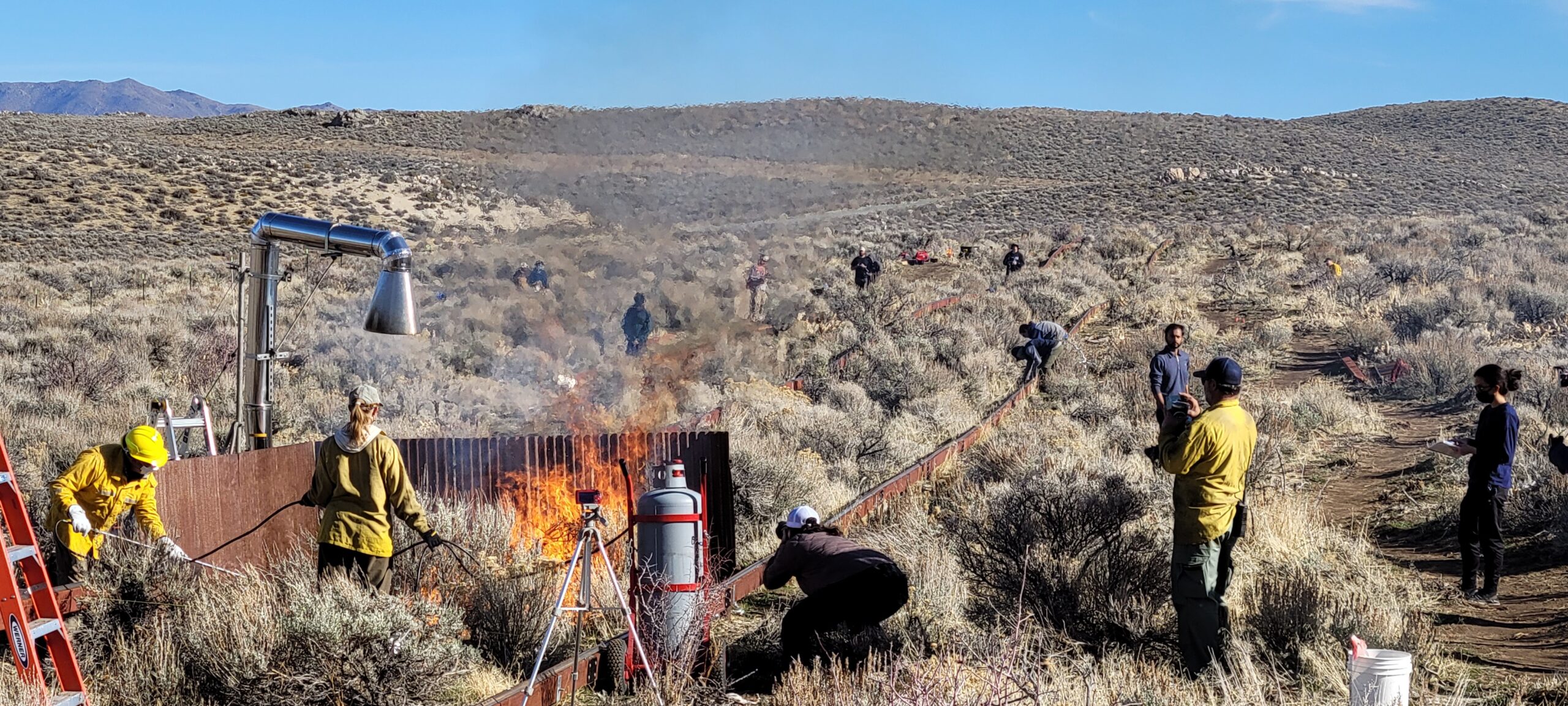
The controlled burns, carried out under the supervision of local firefighters, represent a major milestone in the HDRFS project. Credit: Scotty Strachan
“It felt like all this work from so many people over the previous few years was finally coming together,” says Gabrielle Boisrame, an environmental engineer at the Desert Research Institute and member of the Hydrology component who participated in the controlled burns. “I’m very excited to be able to track how the site evolves over the coming years.”
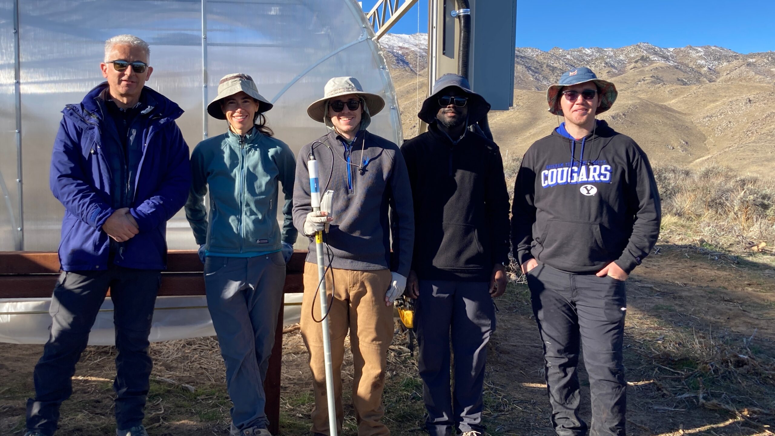
The Hydrology team (pictured) participated in a series of controlled burns at the project field site outside Reno, Nevada, last November. Credit: Gabrielle Boisrame
Each HDRFS component had its own objectives associated with the controlled burns, and for the Hydrology team, that means studying how fire modifies the soil, and how that interplay changes based on which types of plants are present. Some plants likely burn hotter than others, for example, or shed more leaf litter onto the ground, allowing the fire to smolder for longer. It’s also thought that the soil will become more water repellant after burning due to physical and chemical changes, contributing to increased erosion and less water availability for emerging seedlings in the days, months and years following the fire.
All of these are just hypotheses, however, and the group is keen to see how these ideas, which largely stem from observations made across other landscapes, hold up for sagebrush ecosystems. Far less is known about sagebrush compared to forests or plains — even though sagebrush covers one-third of the lower 48 — in part because they’re less lucrative for industries like logging and agriculture. In addition, most wildfire studies only begin after an area has already burned, meaning it’s rare to have the sort of before and after data that the controlled burns provide.
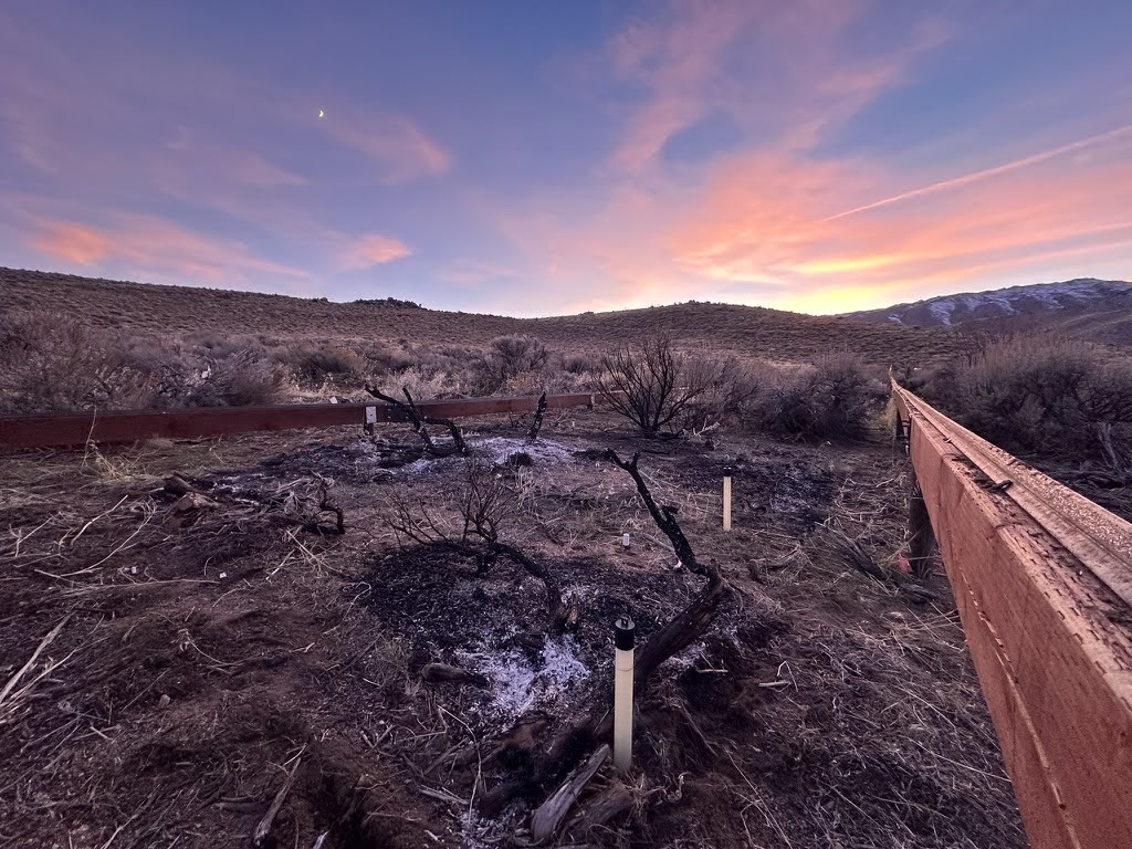
Sensors were re-added to the plots following the burn to monitor soil recovery over the coming months. Credit: Nic Beres
To tackle their research questions, the Hydro team has had to modify their tools to work within these understudied ecosystems. At the field site, each of the plots is studded with a handful of sensors, which monitor different variables over time. One batch of sensors takes measurements of soil temperature and water content near the surface every fifteen minutes, while another measures moisture at slightly deeper depths on an opportunistic basis.
The sensors don’t actually measure moisture directly, though. Instead, they measure the rate at which electrical pulses move through the soil, which changes based on moisture content. Translating these electrical signals into usable measurements requires calibrating the sensors to the specifics of the soil, and it’s here that the equipment has struggled.
“Because they’re calibrated for agricultural soils, the sensors don’t measure as accurately in the desert’s dry, rocky soils,” says Conor Croskery, a research assistant at the Desert Research Institute in Reno. At extremely low water levels, for example, the probes will simply register a value of zero, and they also struggle with the desert’s aggressive temperature swings and the soil’s relatively high levels of salt.
Croskery has been working alongside other members of the Hydrology team, including Joshua Okyere, a second-year PhD student at the University of Nevada, Reno, to make better use of the raw data coming from the sensors. To do so, they’ve had to develop corrections that smooth some of the variability in the measurements attributed to the temperature differences between seasons. And now, they’re working on a series of mathematical equations that calibrate the data based on lab experiments that compare field measurements to those taken from soil with a known volumetric water content.
“The tradeoff we’re making is that these sensors will always be an indirect measurement of soil moisture,” Croskery says. “But we can also keep these probes out there running continuously in a way we could never do with just people.”
The team is only just beginning to look at the data from the controlled burns, but already, Boisrame says there have been some surprising results. It’s thought that fires make soils more water repellant, and yet the group found that soils beneath sagebrush plants were naturally quite repellant even when the land hadn’t burned in many years. While the reasons are still unknown, sagebrush is known to contain waxy compounds that help the plant retain water, but could also wind up on the soil. “Understanding this result is important for modeling potential changes to storm runoff after fires,” she says.
The long term goal is to study how soil hydrophobicity contributes to flooding and watershed health post-fire. If water cannot penetrate the soil, it instead runs over the surface of the landscape, eroding the ground and carrying contaminants into nearby water bodies. Modeling these processes is complicated, but the experiments at the Red Rock Road site will help the Hydrology team create simulations underpinned by real-world data.
For his dissertation, Okyere is currently working with more than a year of pre-fire data and some of the preliminary post-fire data to create a new model. To start, Okyere says he’s limiting the pilot to a single plot from the field site, which measures 12 square meters. In addition to the team’s soil measurements, they’re also incorporating information about the plant communities from the Ecology component.
Over time, and with more data, the group will begin scaling up to cover larger areas, such as hillsides or even entire watersheds, and ultimately use the models to predict hazards such as flash floods and debris flow contamination.
“It will be interesting to see how the plots bounce back this coming spring, and in the years after,” Okyere says. “I have some ideas about which variables I think will be most important, and which things we will really need to understand about the soil to make predictions that apply to an entire watershed.”
 Acknowledgement: This material is based upon work supported by the National Science Foundation under Grant No. OIA- 2148788.