HDRFS Researchers Developing Drone to Collect Valuable Soil Data Post-Fire
The remotely-operated robot will be able to access places deemed too remote or unsafe for people to enter.
By Amanda Heidt
November 2023
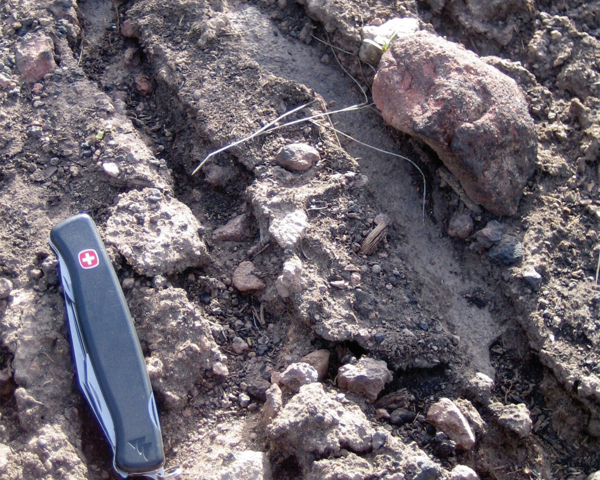
Soil erosion after the 2008 Gleason fire in a sagebrush ecosystem near Ely, NV (Image Credit: Markus Berli)
Members of the hydrology and cyberinfrastructure innovations branch of the Harnessing the Data Revolution for Fire Science (HDRFS) project are developing a remotely-operated drone that can fly into freshly-burned areas to collect valuable data on the condition of the soil. This information will help federal agencies develop flood risk management plans and assist scientists studying long term hydrological trends in the sagebrush ecosystems that make up much of the West.
Markus Berli, an associate research professor of environmental physics at the Desert Research Institute (DRI), Las Vegas, said that the project will address long-standing questions in the field of soil physics and post-fire hydrology, and that the group leading it is interdisciplinary in a way that few research endeavors are. “It’s a collaborative effort between hydrology, soil science, and computer science, as well as robotics and engineering,” Berli notes, adding that “rarely do you see that kind of partnership to develop a new method or tool , and we’re hopeful we’ll be able to collect some very valuable data.”
When fires burn through an area, they often change the properties of the soil, but it’s not always clear how, how much, or what the long-term impact of those changes will be. One way that scientists monitor soil is by conducting a water drop penetration time (WDPT) test—a measurement of how long it takes a drop of water to be absorbed by the soil, which in turn tells scientists something about the soil’s water repellency. Soils tend to become more water repellant after a fire, making them prone to erosion and fostering flooding and debris flows.
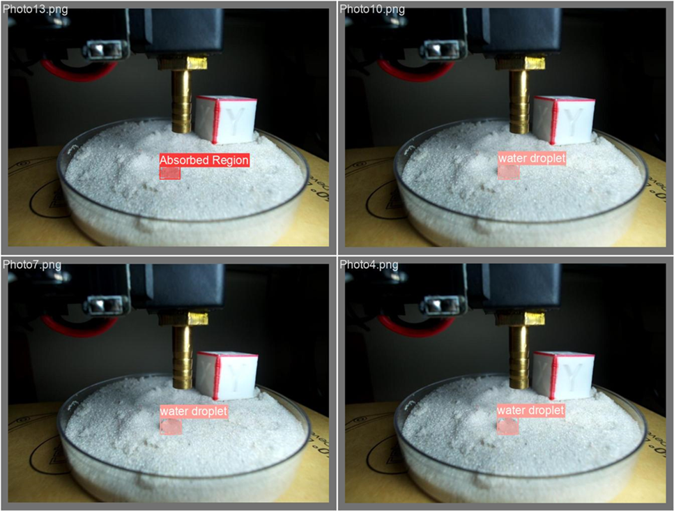
An electronic pipette fitted on the drone’s arm will be able to conduct a water drop penetration time (WDPT) test, which tells scientists how likely soil is to erode after a fire. (Image Credit: Venkatesan Muthukumar)
In the immediate aftermath of a fire, this water repellency information is therefore crucial in determining how likely an area is to flood if it receives a sudden burst of rainfall. Agencies such as the Federal Emergency Management Agency (FEMA) and the US Forest Service (USFS) use WDPT data to create flood risk maps, determine evacuation needs, and decide how best to protect communities living downstream from fires. But accessing newly-burned areas, especially when a fire may still be active nearby, comes with risk.
“Wildfires are dangerous places, and in the West, some of these fires are huge,” Berli said. “You cannot go everywhere, especially immediately after a fire, to run these tests, but we could send a robot.”
Venkatesan Muthukumar, a professor of electrical and computer engineering at the University of Nevada, Las Vegas (UNLV), is working with Berli to develop a remotely-operated drone capable of conducting WDPT tests in the field. The robot—which is roughly the size of a microwave mounted on four telescoping legs—can be sent to specific waypoints, where an arm fitted with an electronic pipette will carry out the WDPT test. The field is unpredictable, and so the drone will also include landing stabilizers, cameras for collecting images and video, and lighting to make the images more uniform for later analysis.

HDRFS scientists are currently developing a drone that will be able to fly into newly-burned areas to collect data on the repellency of the soil. (Image Credit: Venkatesan Muthukumar)
All of this gear is heavy, and so Muthukumar is currently tweaking the drone to make sure it can carry everything without drastically limiting its flight time. Instead of the four rotors on a standard drone, it has eight, and the next goal is to optimize the instruments to be as light as possible, he said. “This has not been just one fun engineering challenge, but many fun engineering challenges.”
Over the long term, the group is also interested in looking at how long soil’s water repellency lasts. Some researchers say that repellency eases after a single rain, while others point to soils that have remained repellant for years. The true answer is complicated by the fact that most hydrological models made over the last century were developed for agriculture and based on moist soils with few rocks—the exact opposite of a desert ecosystem. “We’re just now in the phase of trying to figure out how standard soil physics applies to these systems,” Berli said.
Understanding these questions will lead to stronger hydrology models that will be increasingly important under climate change, as fires are expected to grow more common and rainfall patterns to change . And the pair is also interested in other information that may be contained inside a drop of water. A drone can collect hundreds, even thousands of samples, and the advent of machine learning means that computers can extract previously-unseen patterns from images and videos. The National Science Foundation Established Program to Stimulate Competitive Research (NSF EPSCoR), which funds the HDRFS project, is supporting two students to work on the drone project, including a master’s student who will investigate image post-processing tools.
“Thanks to this great technology, we could actually get way more information out of that drop than just the time,” Berli said. “There are a whole bunch of things that are emerging now that we would have loved to do for the last 10 years, and can only do now.”