HDRFS scientists piece together the puzzle of smoke
Researchers are collecting valuable data on how smoke forms and what happens as it ages in order to fill pressing knowledge gaps.
By Amanda Heidt
March 2024
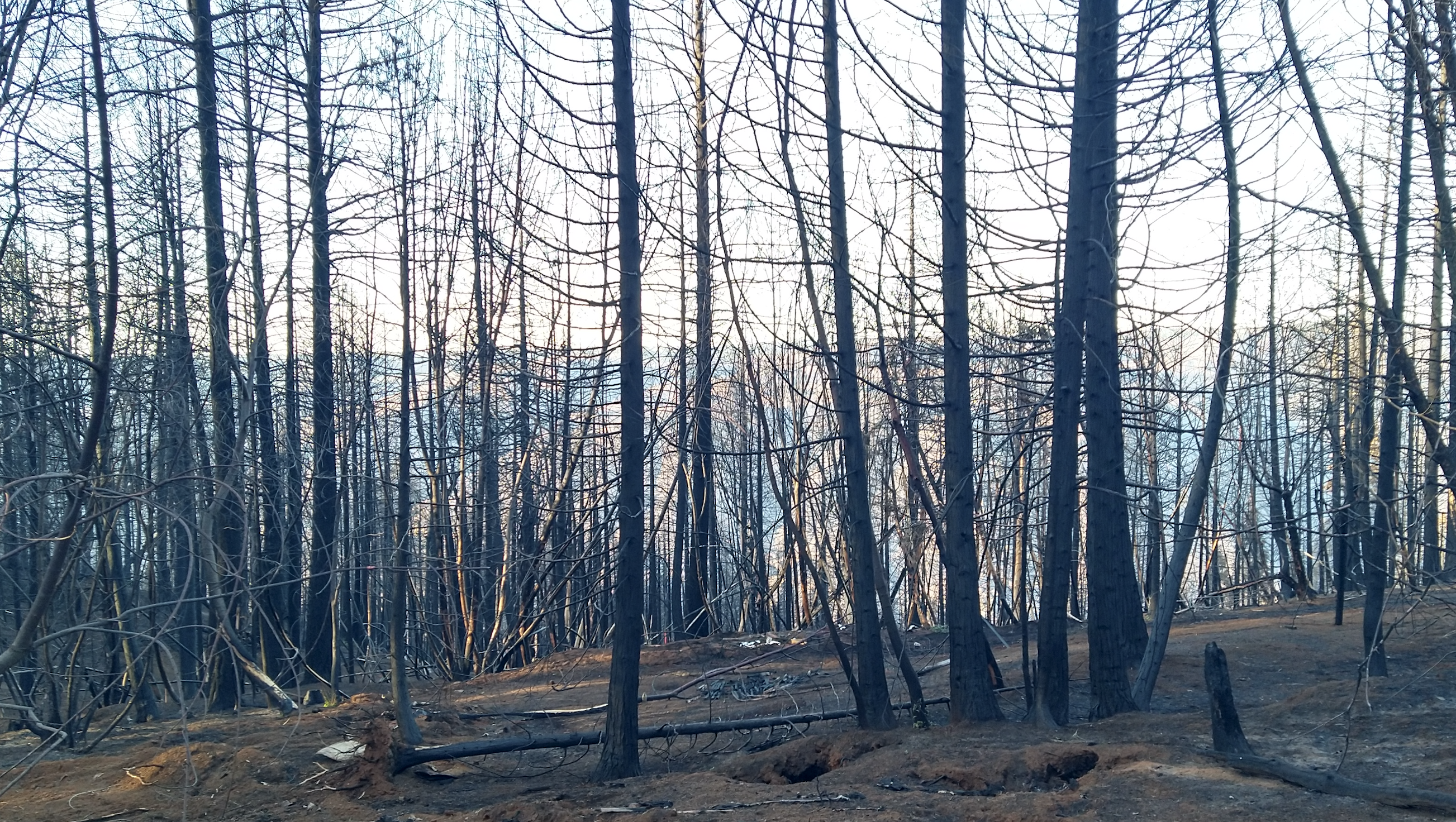
New studies by HDRFS scientists will help determine how quickly a burn site, such as this one, from the Mosquito fire in California in 2022, can recover. [Credit: Vera Samburova]
“For all that scientists have learned about smoke, there’s still so much that no one really knows, and those blind spots can leave us in a risky place,” says Andrey Khlystov, an atmospheric chemist at the Desert Research Institute (DRI), Reno.
To shed light on some of these unknowns, Khlystov and his colleagues in the fire emissions and their atmospheric aging (FEAA) component of the Harnessing the Data Revolution for Fire Science (HDRFS) project recently began a handful of studies to determine how smoke forms and ages, and what that means for our soils, climate, and health. They’re focusing on the sagebrush ecosystem—an understudied habitat that represents the largest contiguous ecotype in the continental United States—and approaching their work with the combined expertise of atmospheric science, ecology, hydrology, and engineering.
One of the main goals of the FEAA component is to better understand how smoke forms and what conditions influence its composition. While scientists know that smoke is made up of different types of particles and thousands of chemicals, the exact mix depends on the fuel source, the climate, and whether the fire is flaming or smoldering. And once smoke enters the air, it quickly begins to break down, meaning that “if you’re downwind of a fire, you’re going to breathe something very different than if you were right at the fire front,” says Hans Moosmüller, an atmospheric physicist at DRI. In many cases, these breakdown products are benign, but others become even more toxic.
The team is currently running controlled burns in small laboratory chambers, or in larger barrels outdoors. They collect soil and vegetation from sagebrush landscapes and set them ablaze, surrounded by instruments that can measure everything from the size and composition of the smoke particles, to their optical properties, to the temperature of the soil. They also expose the smoke to an instrument that accelerates the ambient aging process, allowing them to study the breakdown products that emerge. These burns, Khlystov says, are an exploratory sandbox that will help the researchers make sense of patterns in much larger, less predictable fires.
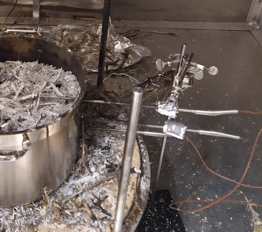
Controlled fires allow the researchers to study the burn using many methods, such as probes to monitor the temperature across a vertical column of soil. [Credit: Vera Samburova]
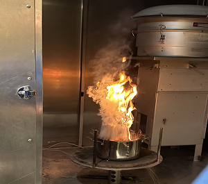
Members of the fire emissions and their atmospheric aging group are carrying out controlled burns to study smoke formation and evolution. [Credit: Vera Samburova]
Making that jump to the field is critical, as it’s here that some of the most important data are lacking. One problem, Moosmüller says, is that the evolution of smoke is dictated in large part by what happens in the first half hour or so, close to the fire where the smoke forms. But collecting those samples, so near to the source, is risky. “Agencies like NASA have done these big, expensive emissions studies with large aircraft, but they can’t get that early smoke evolution—which is really key for the final smoke properties—because they can’t fly close enough,” he says. “That’s one thing that’s unique about our project: we’ll be using drones to fly right near a fire.”
Much like the drone apparatus being developed by the hydrology and cyberinfrastructure innovations branches of HDRFS to collect valuable post-fire data in the field, the FEAA drone will be used to safely access an unpredictable environment. The intent is to fly the drone right up to a fire to collect smoke as it forms to conduct measurements of the temperature, relative humidity, and levels of carbon monoxide and dioxide. The team is currently working with the US Forest Service to test the drone during future controlled burns.
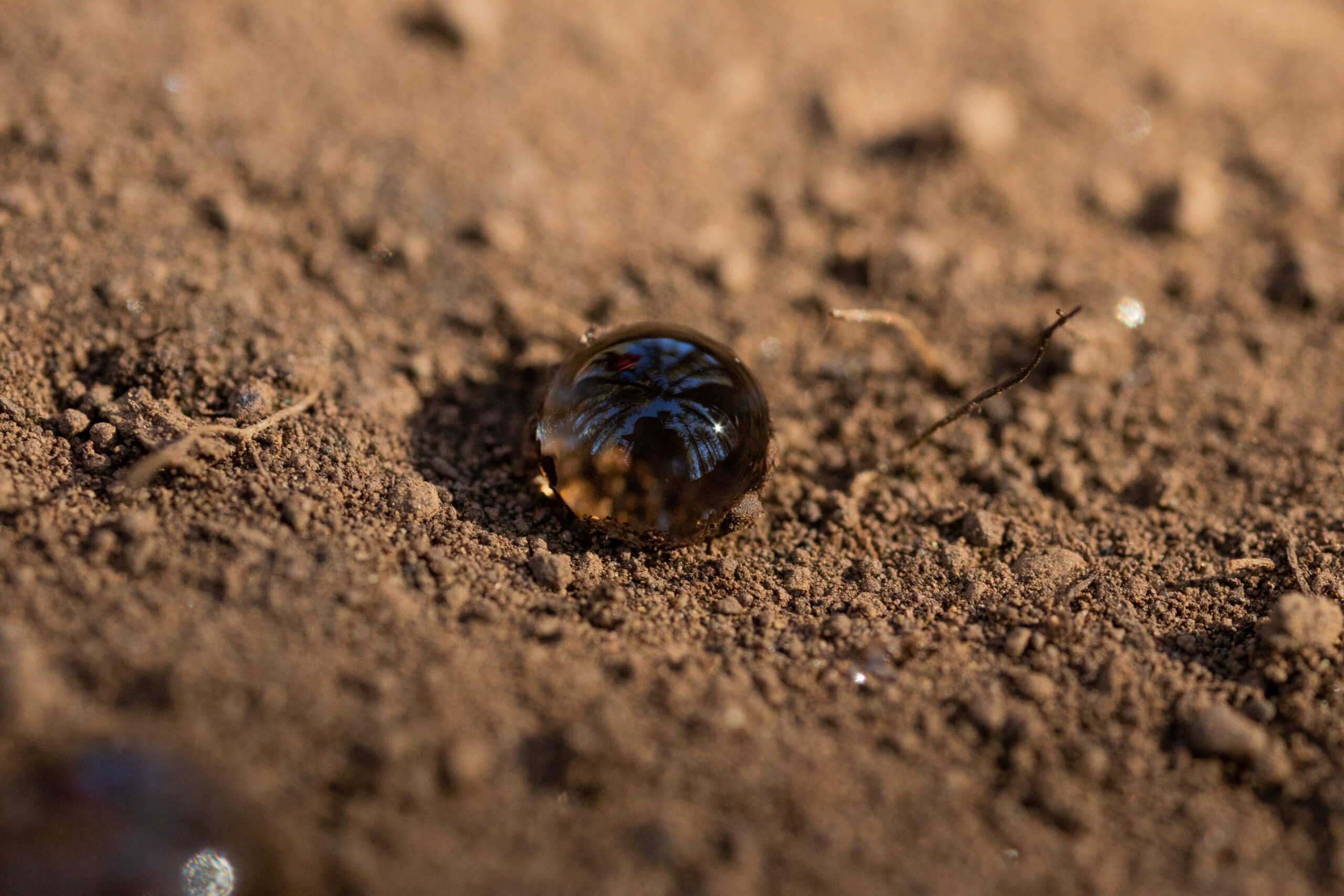
Soils often become more water repellent after being burned, but scientists are still working to understand why. [Credit: Francisco Cereceda]
“The fundamental knowledge of what’s going on to create this soil repellency still has a huge gap,” Samburova says. “Our goal is to figure out how temperature and the nature of the soil organic matter contribute to repellency, as well as what’s going on from the chemistry point of view.”